The PREST project
The aim of the PREST project is to create a regional geosciences research platform to reduce these telluric risks (volcanic eruptions, earthquakes, tsunamis, landslides, etc.), by developing tools and analyses on land and at sea, in particular by testing innovative marine instrumentation, in coordination with Caribbean partners and in interaction with French, European, Caribbean and American specialists.
Most of the major seismic sources threatening the Caribbean islands are located at sea. It is therefore essential to develop techniques for installing networks of underwater geophysical sensors to study these hazards as closely as possible.
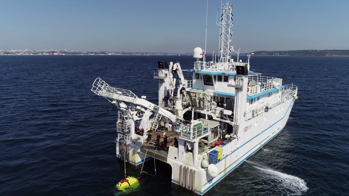
A seismometer at a depth of 40 metres
As part of this project, led by the Observatoire volcanologique et sismologique de Martinique of the Institut de physique du globe de Paris (OVSM-IPGP), an exceptional oceanographic campaign began on 1 June 2021.
This is the culmination of several years’ research and development into fibre-tip optical sensors, carried out by IPGP, ESEO and ENS, with a view to closely monitoring the seismicity of the Saintes area, which was hit by a magnitude 6.3 earthquake in 2004 and is still affected by earthquakes.

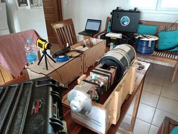
This campaign, designed and developed under the direction of Pascal BERNARD, physicist at the IPGP and head of this axis in PREST, and Guy PLANTIER, director of research at the ESEO and member of the University of Le Mans, an innovative seismometer, an inclinometer and a purely mechanical pressure meter, installed at a depth of 40m underwater and located 4-5 km south of Les Saintes, are linked by an optical cable to Terre-de-Bas (tourist office) where a laser interrogator enables its movements to be measured remotely with great precision.
In addition, the fibre itself will enable the propagation of seismic waves to be tracked at any point along its route, thanks to another optical interrogator placed on land by the Géoazur team. This innovative approach is made possible by monitoring disturbances in the light signal caused by the passage of seismic waves. With a measurement point every 10 metres along the length of the cable, the optical fibre will represent the equivalent of 500 seismometers. The interrogator was developed by the SME Febus Optics.
Qualification of the FIBROSAINTES campaign as part of the PREST project will make it possible to launch more ambitious projects with longer cables, 50 to 100 km long, capable of reaching the source zones of the major earthquakes in the West Indian subduction zone off Guadeloupe and Martinique, and thus finally identifying the ongoing deformation activity that is preparing the way for the next major earthquakes.
Course of the FIBROSAINTES mission
After a week on site, the operation is already well advanced:“The bathygraphy operations (mapping the depths and relief of the area under study) have been completed,” says the members of the engineering team on site. “After a few difficulties caused by nets, they have made it possible to obtain a sonar image of the deployment trajectory.
At the same time, the sailors cleared the trajectory of traps, nets and other objects that could derail the ploughing operations. The shore team was responsible for communicating with the fishermen on the islands about the nature of the operations and the fishing zone to be avoided”
Operation Plough consists of unwinding a cable at the bottom of the sea linking the seismometer (at a depth of 40m and a length of 5km) and the analysis tools located on land.
“The ploughing tests are conclusive in the sandy areas, a small sector where the seabed is made up of rhodolites (calcareous concretions formed from calcified algae), which will require the intervention of divers to ensure that the fibre is properly buried.
The shore team has built a dummy seismometer of equivalent mass and volume, which will be used by the divers for training purposes
Landing operations began on Monday 07 June. The aim is to deploy and secure a section of the optical cable from the tourist office premises (from the premises, researchers and engineers are installing the optical acquisition system for the measurement station and testing the fibre throughout the deployment of the instruments at sea).
A chain of cast-iron hulls will be assembled around the underwater optical cable, to protect it from port activity, tidal range and the vagaries of the weather.
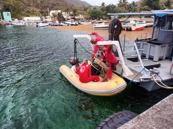
Successful deployment in Les Saintes of the seismometer and optical interrogator developed by the GSII-LAUM team and ESEO-TECH ingénierie
Its objective is to deploy an underwater observatory 4-5 km south of Les Saintes, to study in real time the seismic movements in the area, which is one of the most active in the Caribbean arc. Philippe MENARD and Guillaume SAVATON joined the PREST (Plateforme Régionale de Surveillance Tellurique) project teams on site to help deploy and commission the seismometer and optical interrogator they designed specifically for the project.
These optical measurement instruments, developed entirely by the GSII-LAUM and ESEO-TECH engineering teams, are the fruit of a ten-year collaboration with the seismology team at the Institut Physique du Globe de Paris (IPGP).
From the boat chartered by Ifremer, the crew aboard the Antea and professional divers were responsible for preparing the area where the underwater observatory would be set up, unwinding and then protecting the 5 km of optical cable linking the seismometer, submerged at a depth of 40 m, to the optical interrogator based on land.
After a two-week mission, and despite occasionally rough weather and seas, the connection to the optical interrogator was established and revealed the first seismic signals.
The success of the FibroSaintes mission confirms the expertise and know-how of the GSII-LAUM and ESEO-TECH ingénierie teams in the development and design of innovative sensors for optical measurements in constrained environments.
